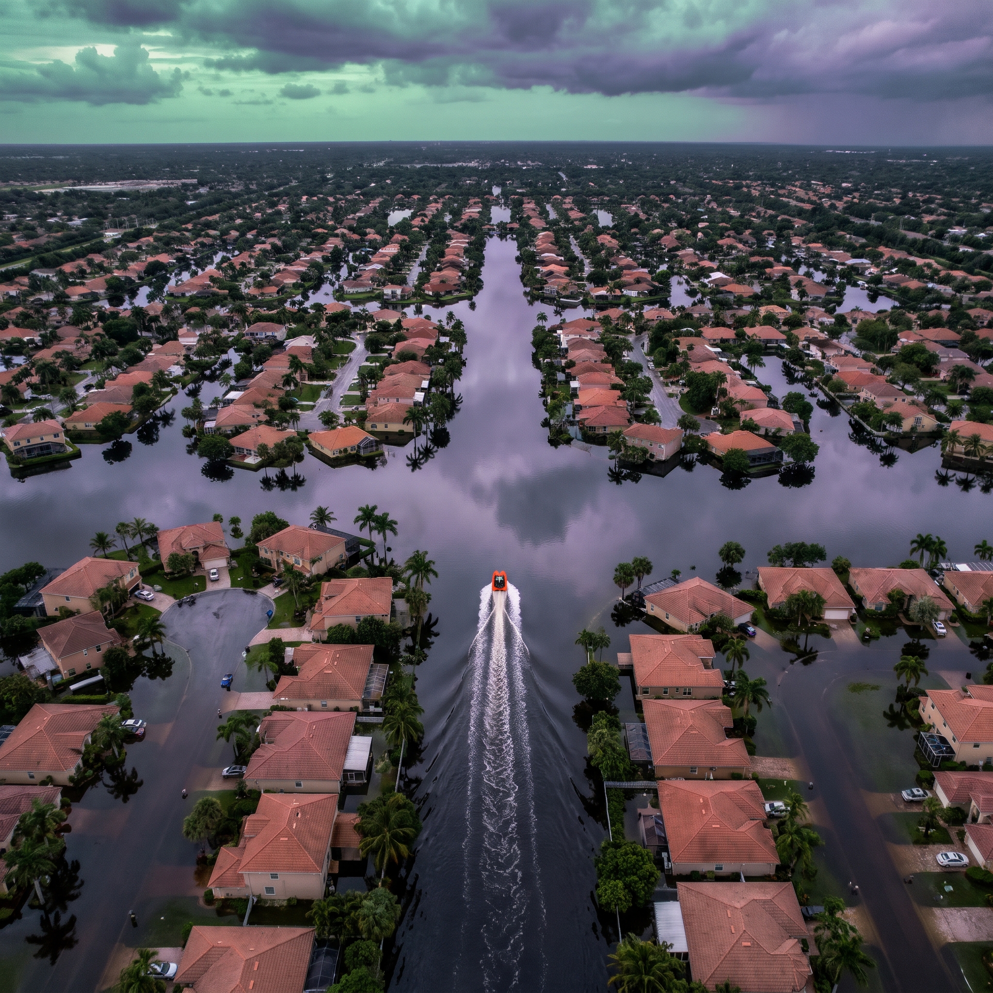
Eliza Ward: Hi. Let me start with a strange one. The rain eased in central Florida and the river kept going up.
Brian Reed: Hi. That sounds backwards. Where?
Eliza Ward: Brevard County. The St. Johns River near Cocoa reportedly passed its 1953 record, with a provisional crest of 18.32 feet. Scattered rain continued Saturday, Nov. 22, though initial levels eased in some areas.
Brian Reed: Seventy-some years, gone. Okay, so the backwards part: think of the ground as a sponge that's already full. It can't take more, so the water slides off toward the river.
Eliza Ward: And the river?
Brian Reed: A slow bathtub drain. Faucet down to a trickle, tub still fills, because the water coming in beats the water going out.
Eliza Ward: So the water's still coming up, and people are already out of their homes. What did the rescue side look like? Sheriff Wayne Ivey says more than 100 water rescues and emergency assists across Brevard County.
Brian Reed: A hundred. Who was doing the pulling?
Eliza Ward: The Brevard County Sheriff's Office, with Florida Fish and Wildlife Conservation Commission airboats. Florida National Guard brought high-clearance vehicles. West Cocoa, Rockledge, Palm Bay. Airboats took families out of submerged streets in West Cocoa.
Brian Reed: And Ivey said, quote, "absolutely no one that has lost their life from this storm. Very minimal injuries." A hundred rescues, nobody dead.
Eliza Ward: That's his on-record statement. Solid.
Brian Reed: But the rescue is the easy part to see, right? Boat shows up, family climbs in, cameras love it. What I don't get is the next morning. Picture a woman in West Cocoa, airboated out, now at her sister's. It's Tuesday. Does she go back and pull up soaked flooring, or stay put with the river still high? And if she goes back, she might be leaving again by Friday.
Eliza Ward: Hold on. Why was it days of rain and not one pass?
Eliza Ward: A high-pressure system over Virginia, plus a low and a stationary front. Together they funneled a tropical moisture plume onto the east coast and parked it. Central Brevard got roughly 10 to over 15 inches. That gap is probably different locations and time windows, but that's my inference.
Brian Reed: Parked. That's the word. Nothing moved, so nothing drained. And honestly, the storm headed for Thanksgiving travel is going to swallow this story, and I think Brevard fades fast.
Eliza Ward: Okay, but that's a forecast against a measurement. I want to test that, and whether zero deaths means preparedness or luck, in a minute.
Brian Reed: Minute's up. A low forming off Florida's southeast coast, moving north around Thanksgiving. Rain, maybe wet snow in the interior Northeast and Appalachians, parades, airports. Millions of people. Tell me Brevard wins that fight.
Eliza Ward: Okay, but as of Nov. 21 that's a forecast. The Weather Prediction Center says it's not likely to reach tropical storm status. So "Storm Kyle" is unconfirmed. The impacts are forecast either way, though.
Brian Reed: Name or no name, the airport delays happen.
Eliza Ward: Probably. But look at the wind. AccuWeather says 60 to 80 mph gusts on the North Carolina coast, Nov. 21 to 22. The Weather Prediction Center says 40 or greater. That's a big gap.
Brian Reed: So which one's right? And the Outer Banks, Highway 12 was already damaged by the September and October storms, and now 1 to 2 feet of surge. I mean, that's a real road, real people cut off. I'm not saying the storm's noise.
Eliza Ward: Wait, here's what cuts against you. AccuWeather also says more downpours could aggravate the ongoing river flooding. Same rivers. The storm doesn't replace Brevard. It could add to it.
Brian Reed: Hang on, that's my point made for me. Storm's a weekend, the flood's a season. Attention goes to the weekend, though. I still expect that. Last thing: zero deaths. Coordination or luck?
Eliza Ward: Coordination, I'd say. Sheriff's Office, FWC, the National Guard, all on the water at once. Luck, I can't rule out. I don't know how close any of those hundred calls were.
Brian Reed: Fair. Here's where I've landed. The storm's the smaller story. Airboats end the rescue. They don't end the displacement. And the land makes it worse: flat, barely above sea level, porous limestone, drainage built for old rainfall.
Eliza Ward: Mine's narrower. Keep the forecast and the measurement apart. The storm is a forecast. The river is a measurement. The St. Johns near Cocoa is the number I'd watch, and I'd still say "provisional" until the gauge page confirms it.
Brian Reed: What still gets me is the 1953 record. Over seventy years, and it falls in a month nobody plans for floods.
Eliza Ward: Dry season. Yeah. That's the line that sticks.
Brian Reed: What changes your mind, then? On the storm being smaller.
Eliza Ward: If its rain hits the Florida Peninsula again. AccuWeather says that could aggravate the river flooding. Then it's the same story, not a rival one. Yours?
Brian Reed: The river cresting and falling. Actually falling, for days. If that happens, the woman in West Cocoa gets to go home, and I'm wrong about it being a season. What do you expect, though? Not the open questions. You.
Eliza Ward: I expect the Thanksgiving coverage wins the week. And I expect the river stays high longer than anyone's planning for. That second part is my inference, not a forecast.
Brian Reed: So the question is whether anyone's still looking at that gauge, and still helping, when the water's down and the flooring's still wet.
Eliza Ward: Will help last as long as the water does? I'd like to be wrong about that one too.